ThinkinAzul is a joint research and innovation strategy for protecting marine ecosystems against climate change and pollution, and for tackling the challenges faced by aquaculture, fishing and tourism.
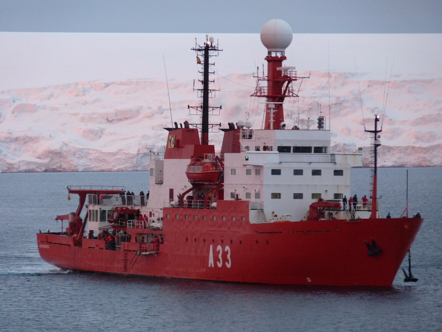
The oceanographic Research Vessel (RV) Hespérides is a ship belonging to the Fuerza de Acción Marítima (Maritime Action Force) of the Spanish Navy based in Cartagena. Its scientific equipment is managed by the Maritime Technology Unit of the CSIC (Superior Council for Scientific Research). It has a reinforced hull for sailing in polar areas. Its main mission is to provide support to researchers in the Antarctic during the southern-hemisphere summer. The rest of the year it operates in the Mediterranean Sea, and the Atlantic and Pacific oceans.
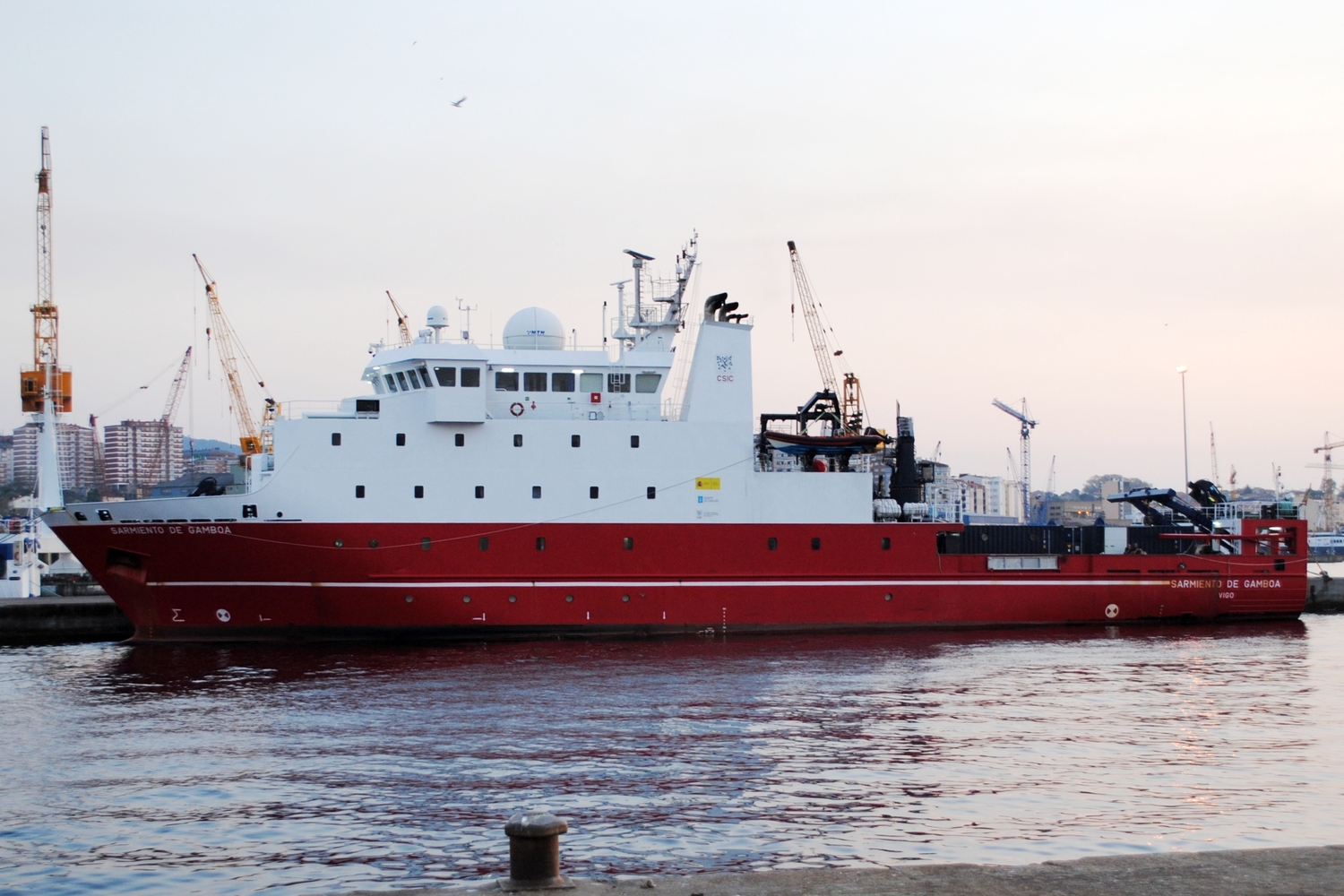
The CSIC fleet consists of three ships and scientific equipment that can be operated from any of the ships in the fleet.
RV Sarmiento de Gamboa RV García del Cid RV Mytilus
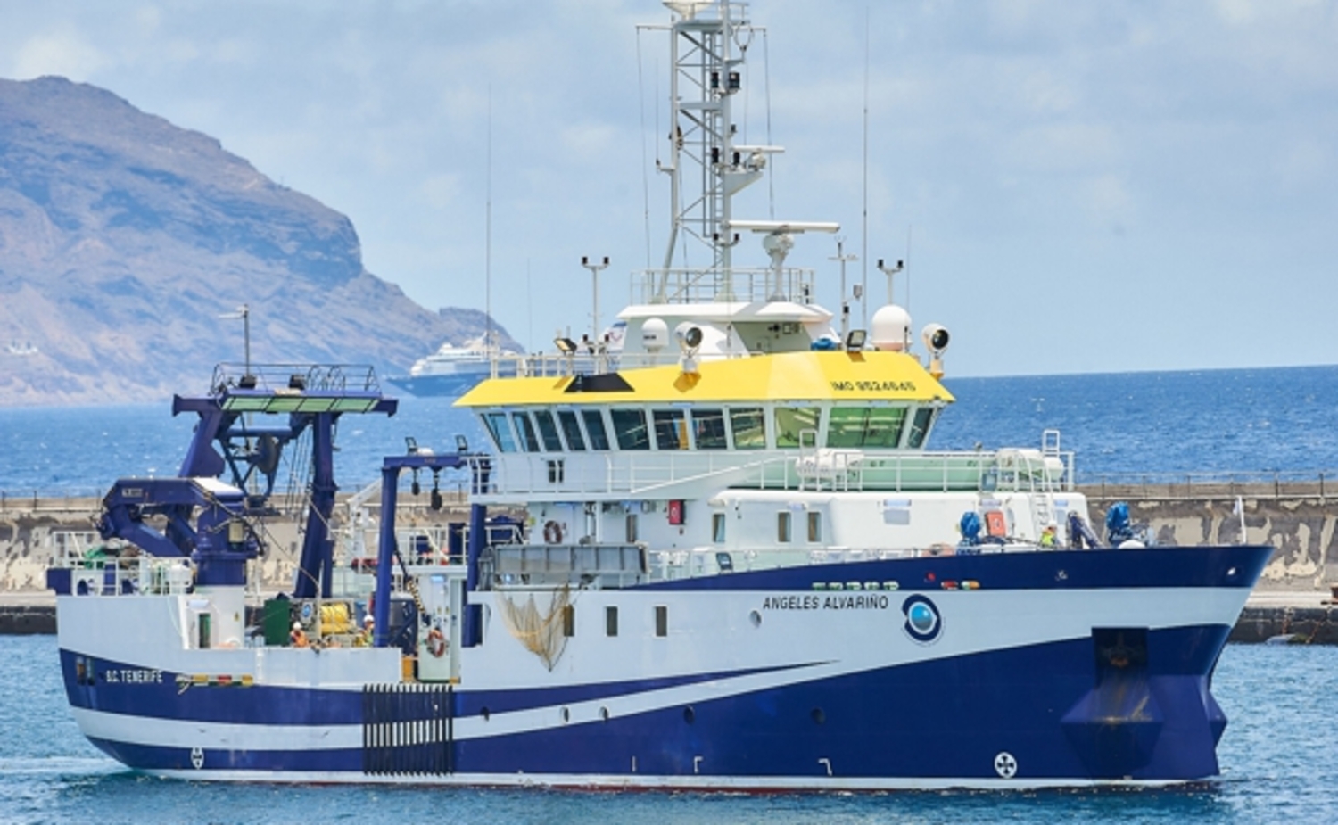
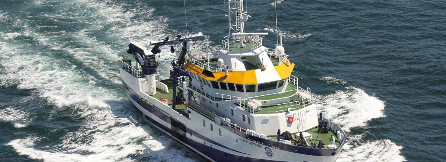
The fleet belonging to the Instituto Español de Oceanografía (Spanish Oceanographic Institute) consists of 5 ships, and a remotely operated vehicle (ROV) that can reach a depth of 2000 m.
RV Ángeles Alvariño RV Ramón Margalef RV Francisco de Paula Navarro RV José María Navaz RV Lura
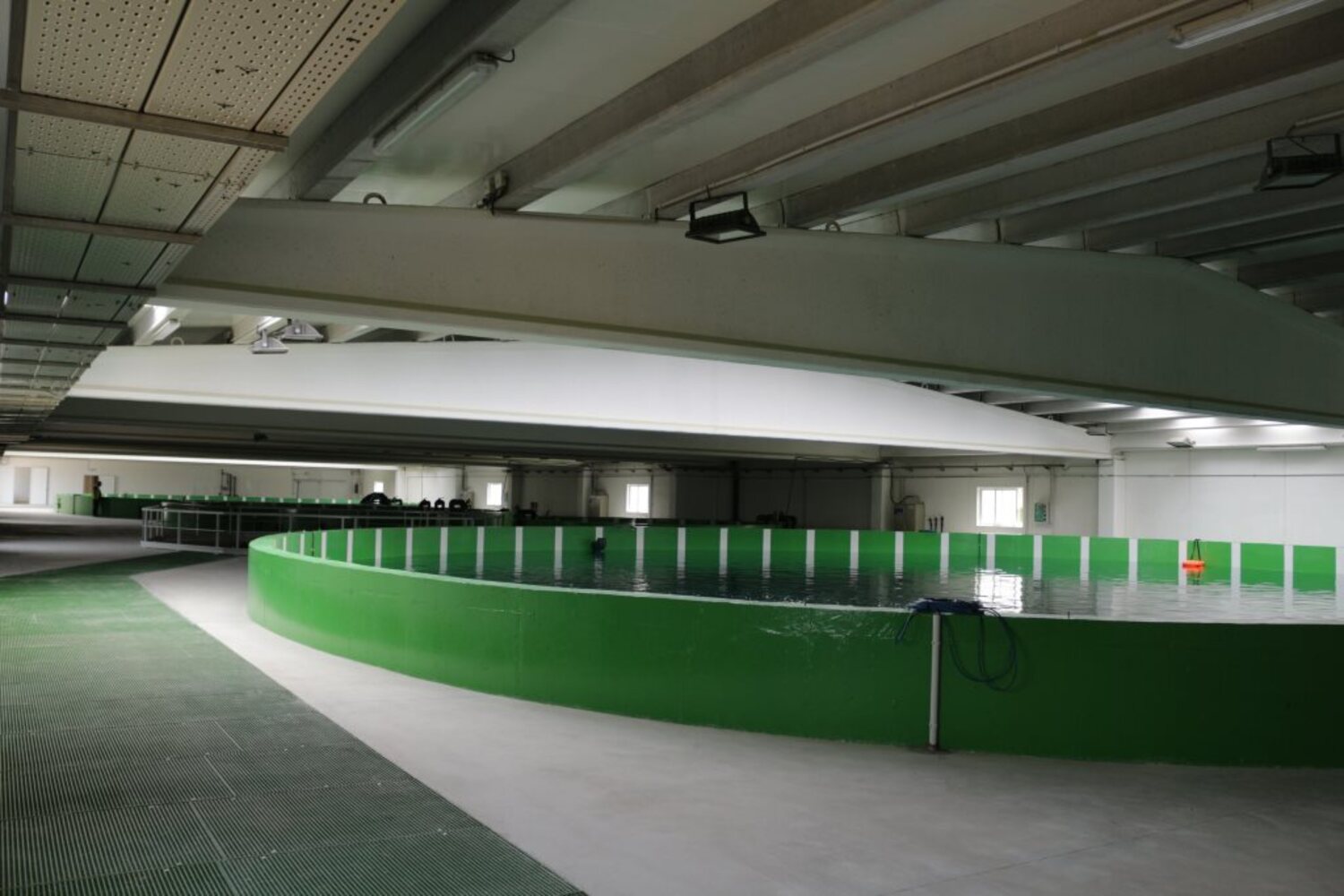
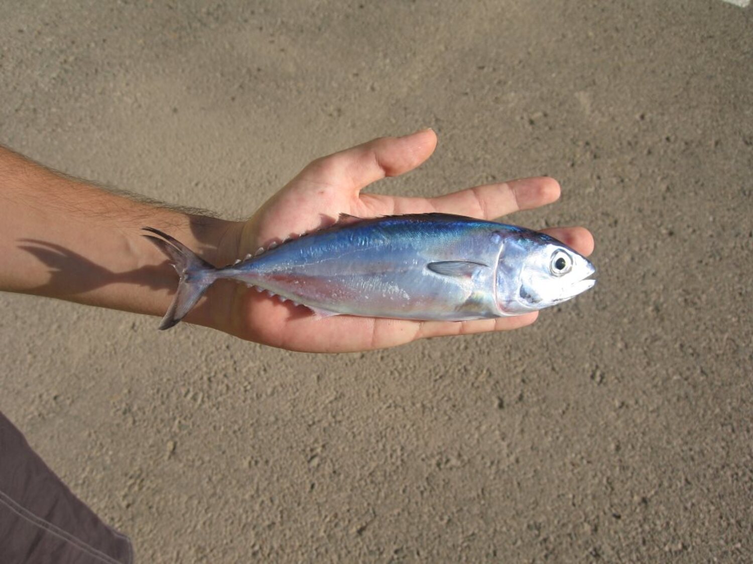
Atlantic bluefin tuna breeding plant (ICAR)
This ICTS (Unique Science and Technology Infrastructure), which belongs to the Instituto Español de Oceanografía, is a research infrastructure that consists of marine aquaculture facilities in the Region of Murcia that are developing reproduction techniques for bluefin tuna held in captivity and the production of bluefin tuna juveniles.
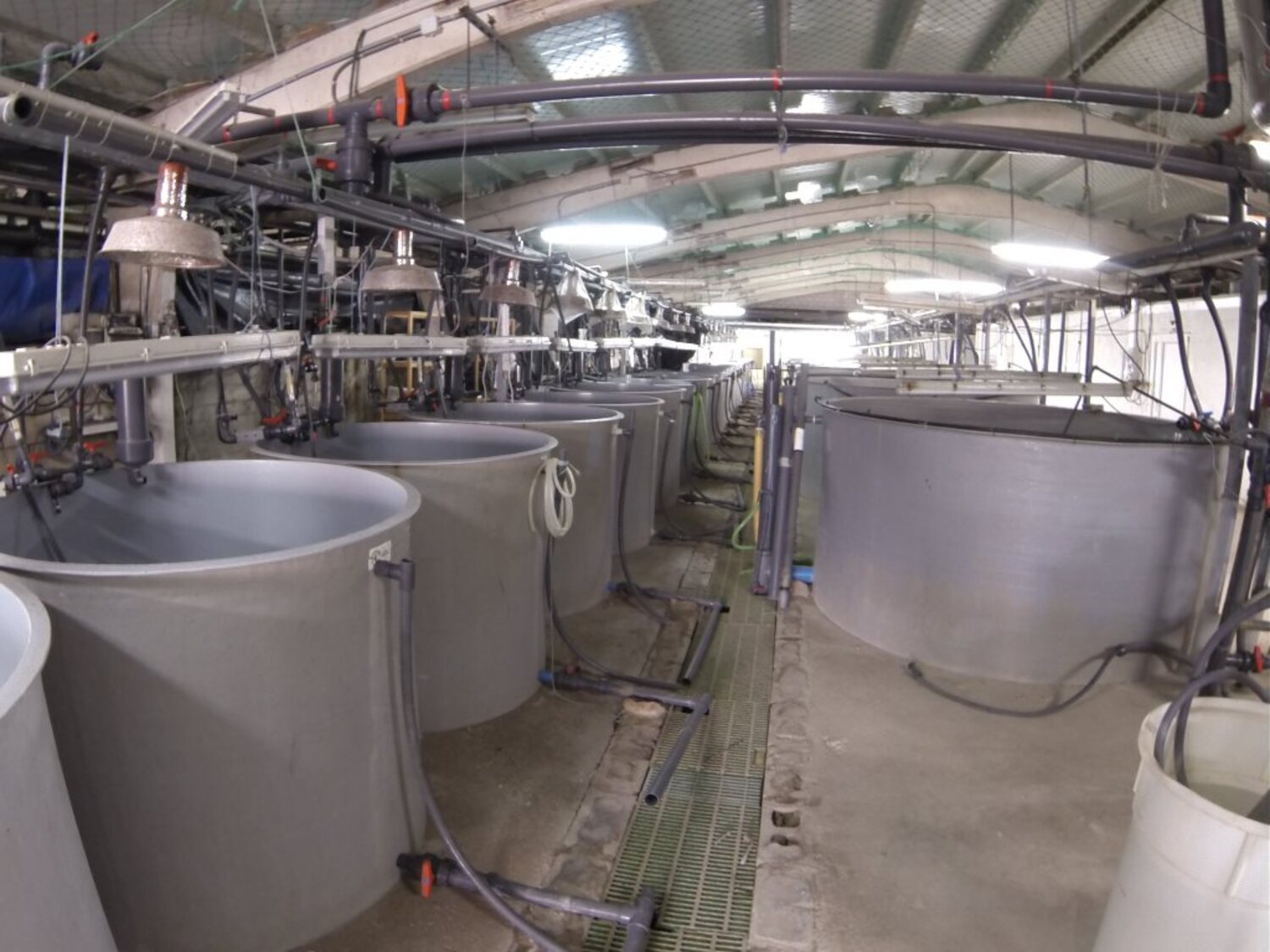
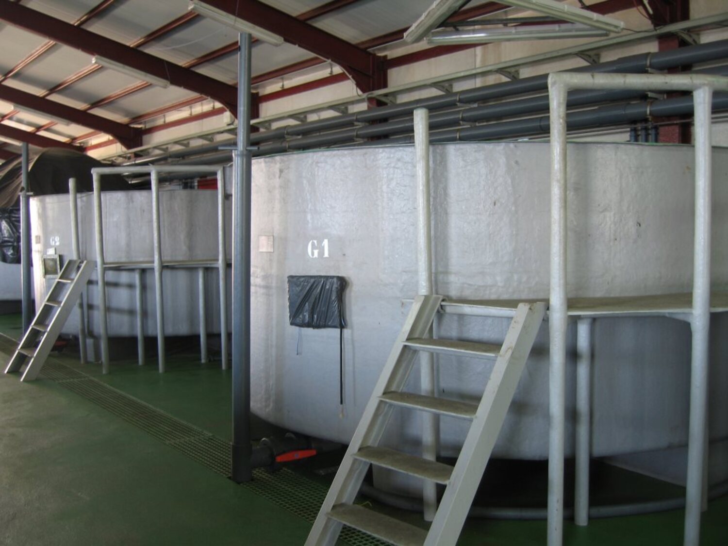
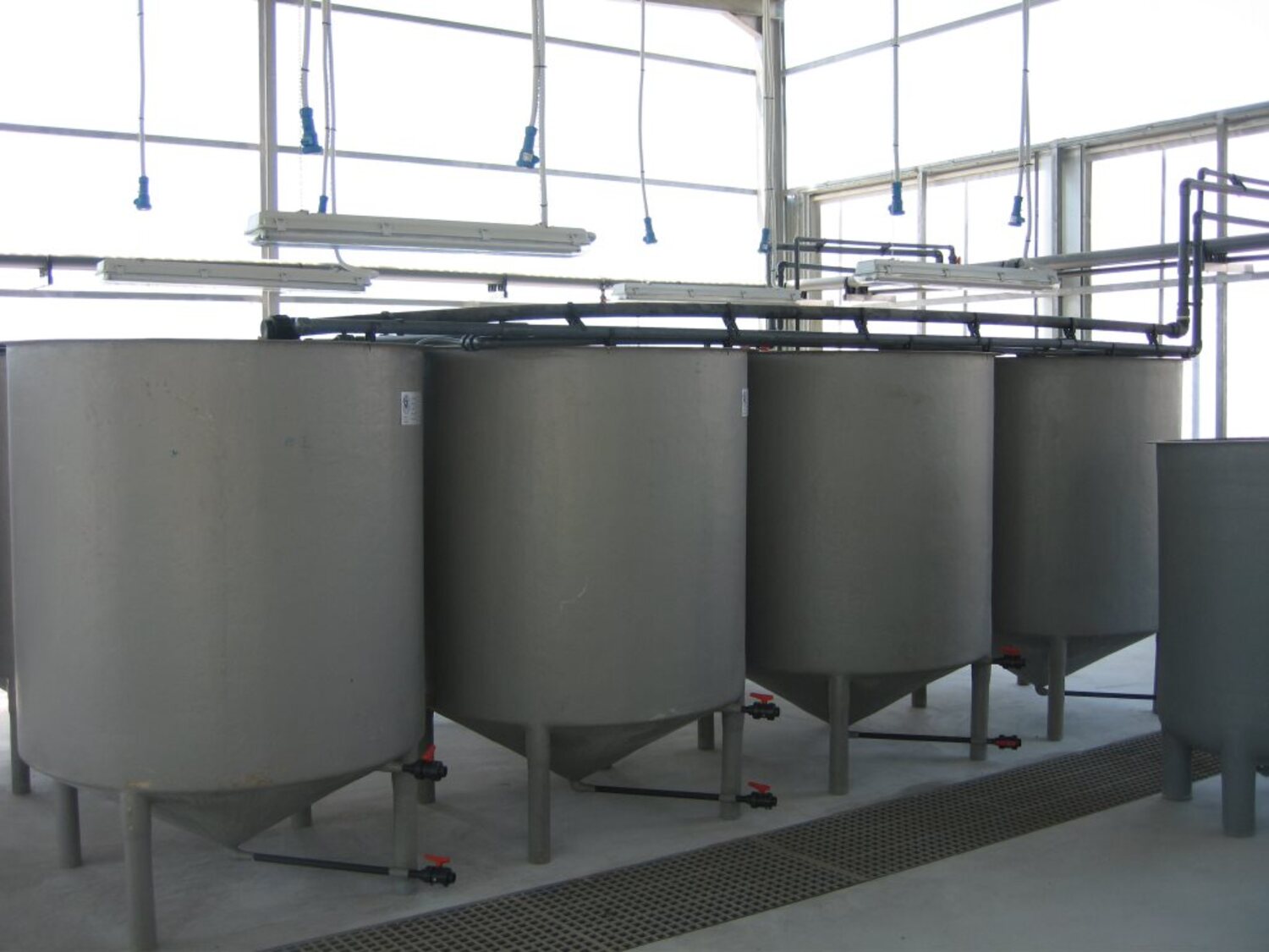
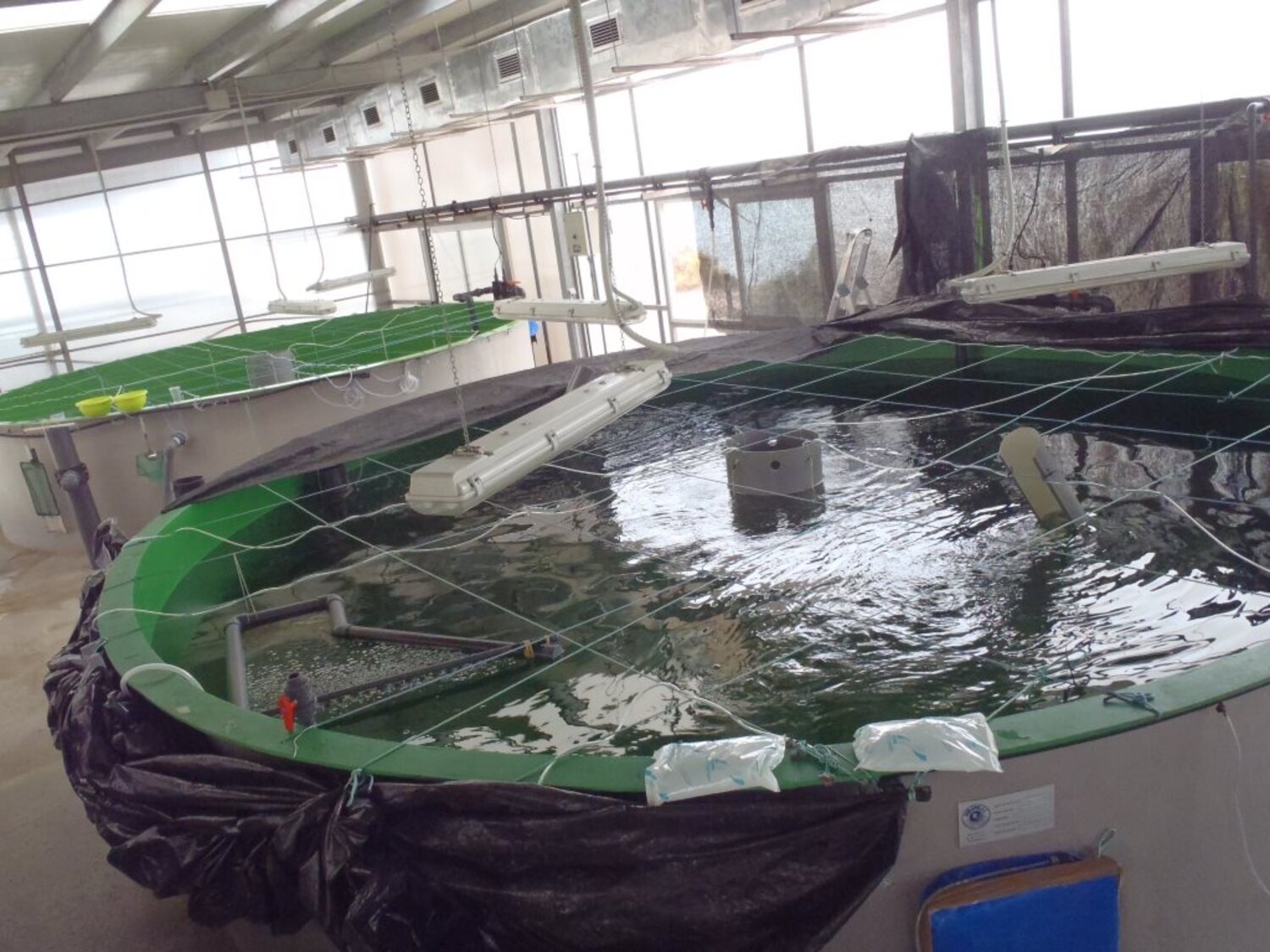
The facilities for the breeding, incubation, larvae rearing, weaning and fattening of Atlantic bluefin tuna are as follows:
Breeding control facility: four tanks with a total volume of around 7000 m3; two tanks of 20 and 22 m3 in diameter and 10 m deep, each with capacity for around 30 tuna weighing approximately 60 kg initial weight, and another two measuring 14 m and 8 m in diameter. The plant is equipped with temperature and light control systems.
Egg incubation unit: 12 tanks with a capacity of 500 l, and 50 tanks with a capacity of 100 l with light and temperature control systems.
Weaning facility: one cylindrical 100,000 l tank, four 50,000 l tanks and 20,000 l tanks with water recirculation and treatment systems.
Rearing facility: seven 5000 l tanks and eighteen 1000 l tanks, two research units with a total of 39 circular tanks with 170 l capacity. The mesocosm unit for rearing larvae consists of two 45,000 l tanks and the phytoplankton, rotifer, brine shrimp and copepod culture facility. All the tanks have water treatment systems and the research units also have recirculation systems.
Spanish Antarctic
Bases (BAE)
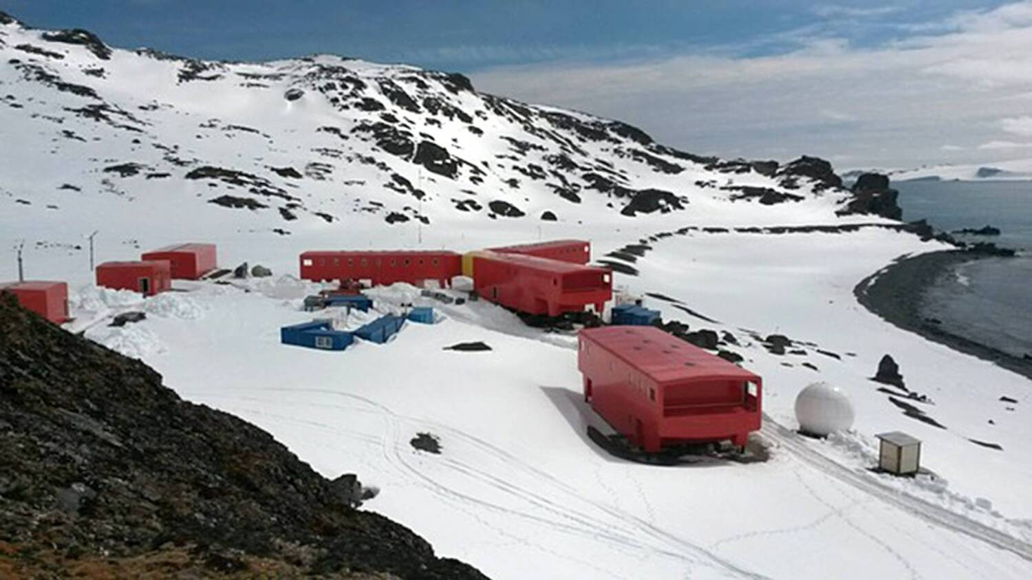
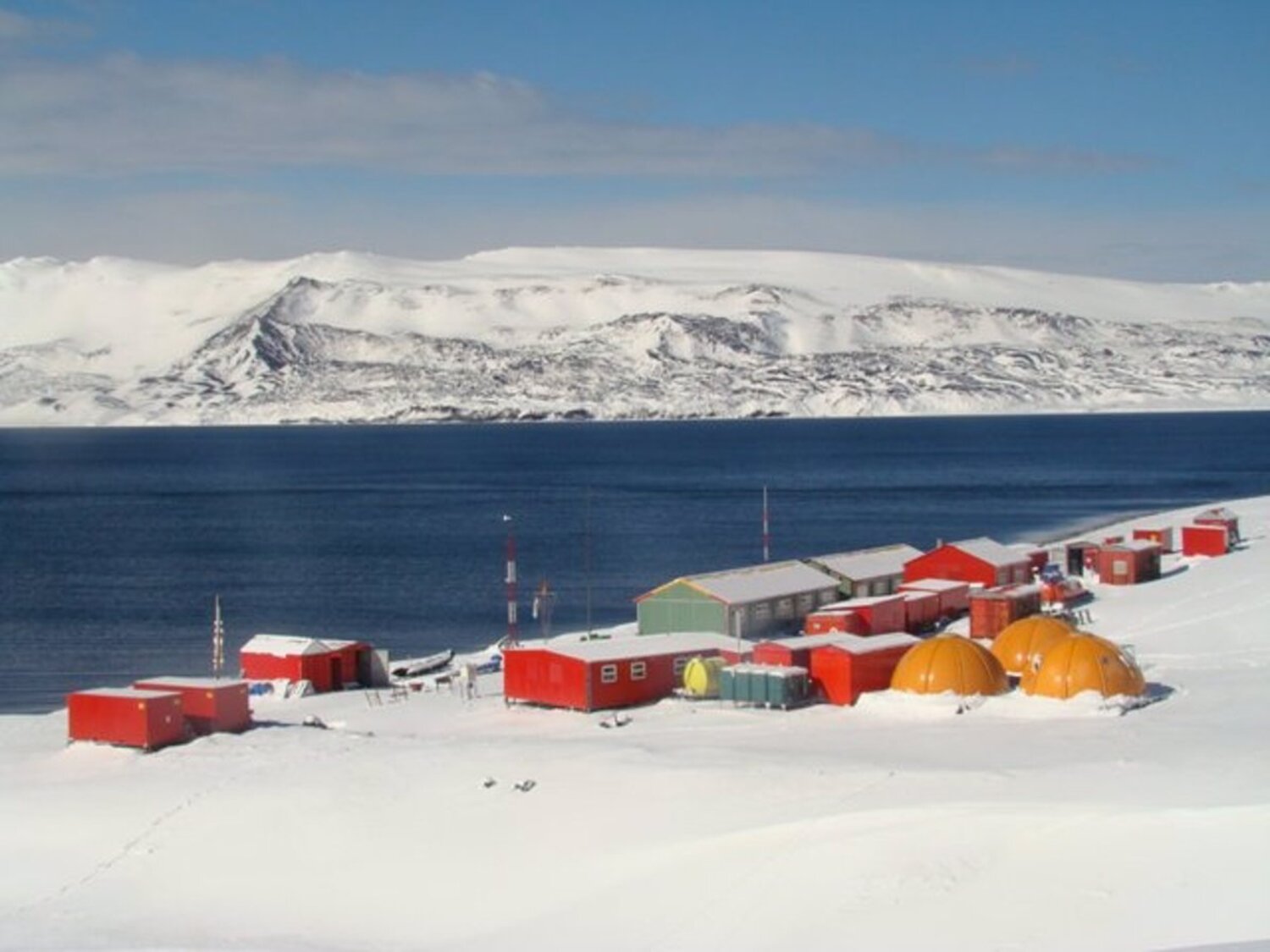
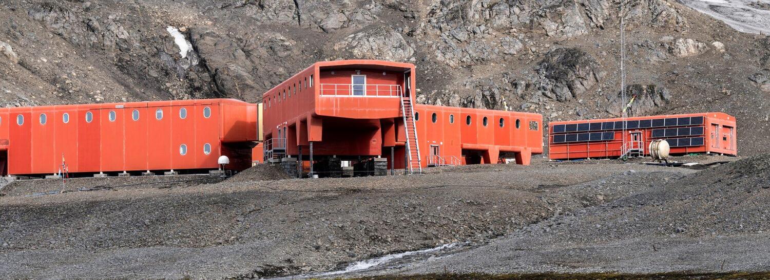
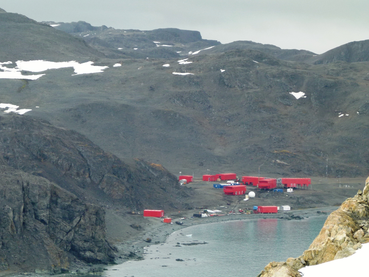
Antarctic Base Juan Carlos I and Antarctic Base Gabriel de Castilla form the ICTS (Unique Science and Technology Infrastructure) known as the BAE. The bases are located on Livingston Island and Deception Island in the South Shetland Islands. They are only operational during the southern-hemisphere summer, usually from November to March.
Antarctic Base Juan Carlos I opened in 1988 and is managed by the Marine Technology Unit of the CSIC. Antarctic Base Gabriel de Castilla opened in 1990 and is run by the Spanish Army.
Access to the BAE is open and competitive, and is regulated by protocol that prioritises applications to use of the facility by the quality of the proposals in terms of scientific and technological value. Activities at the facility fall into two categories:
R&D and Innovation activities for national, European and/or international projects.
Other activities, including social media, knowledge dissemination, facility upgrades and visits by organisations.
Applications for the use of the Antarctic facilities are taken from 1 January to 15 May each year. This includes requests for research activities outside the government R&D and Innovation programme of the State Research Agency and other activities.
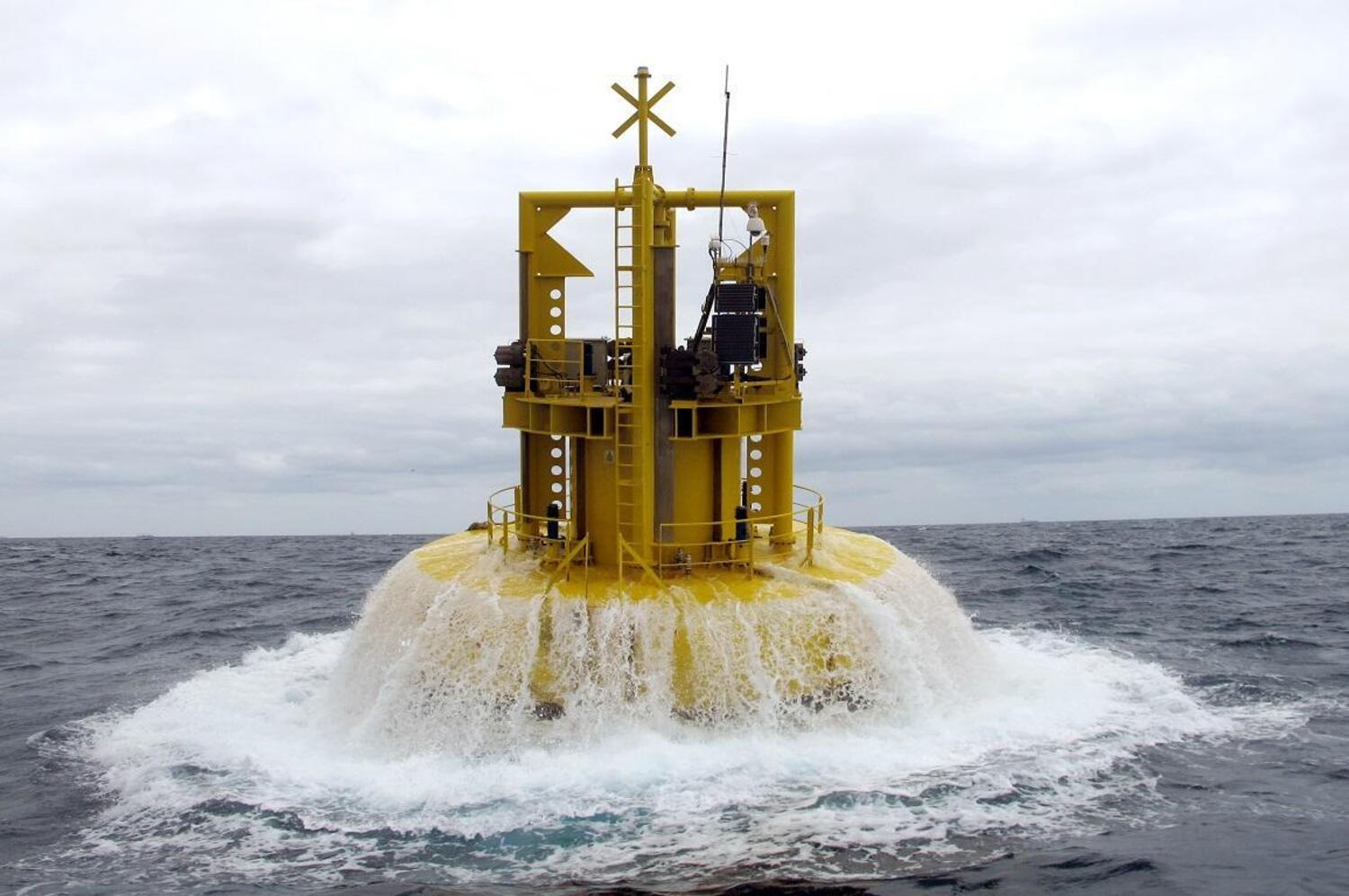
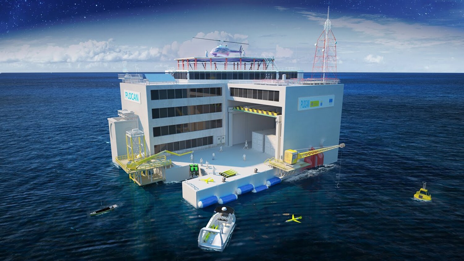
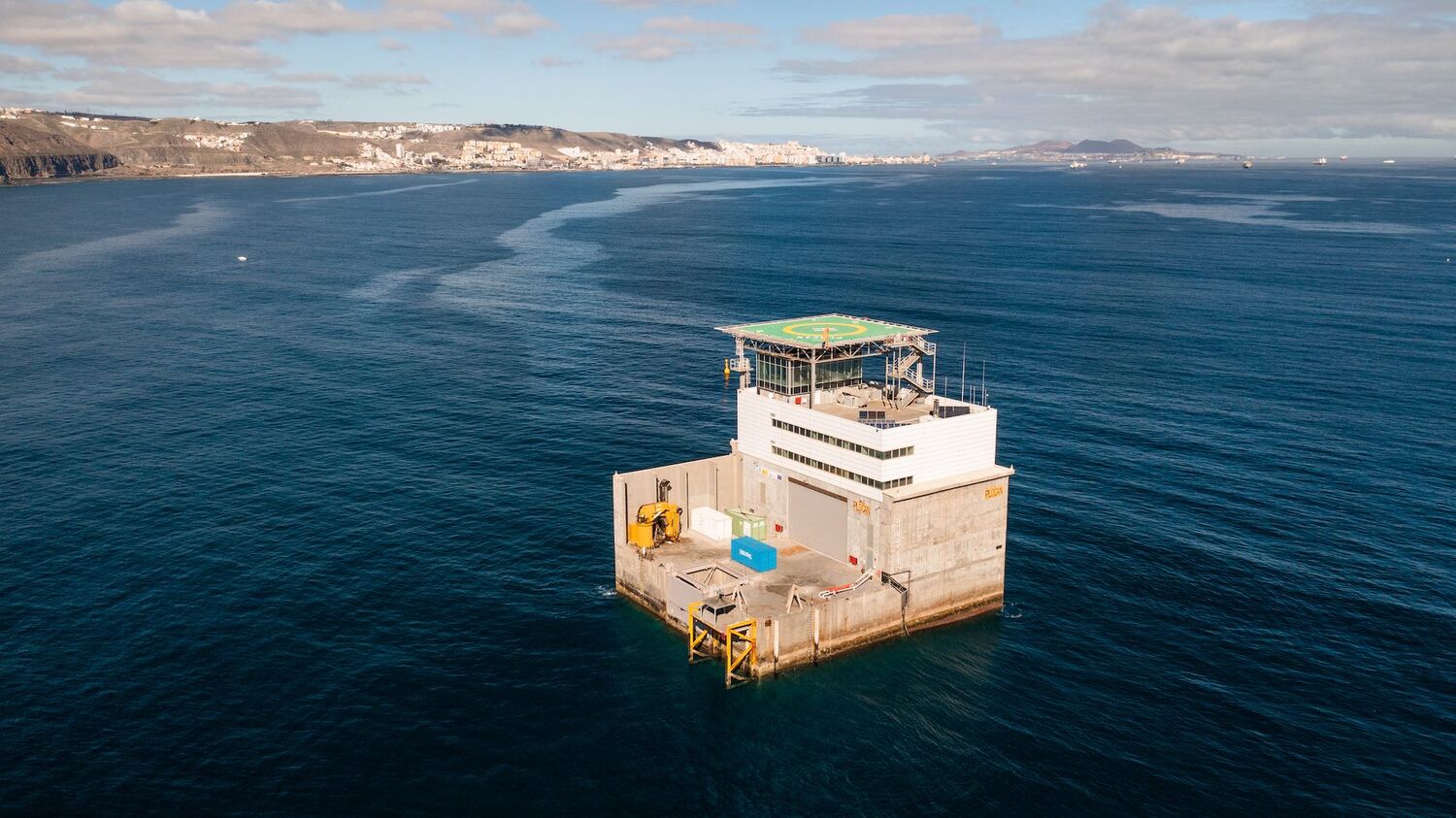
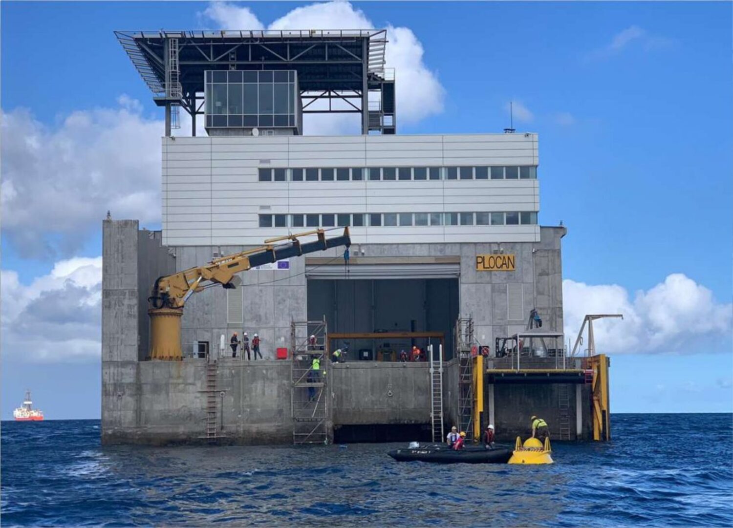
The Oceanic Platform of the Canary Islands (PLOCAN)
The main PLOCAN facility, the oceanic platform itself, is located in open water a mile off the coast of Telde (a municipality in the northeast of Gran Canaria). It is in an area of 23 km2 that is reserved for scientific and technological research.
The Oceanic Platform of the Canary Islands is a facility managed by the PLOCAN consortium (co-funded 50/50 by State Government and the Regional Government of the Autonomous Community of the Canary Islands). Its objective is to perform research, technological development and innovation in the marine and maritime field. The facility provides access to the ocean with the best environmental guarantees, supplying scientific laboratories, vehicles and testbeds, as well as general technical resources and facilities located in the PLOCAN marine area.
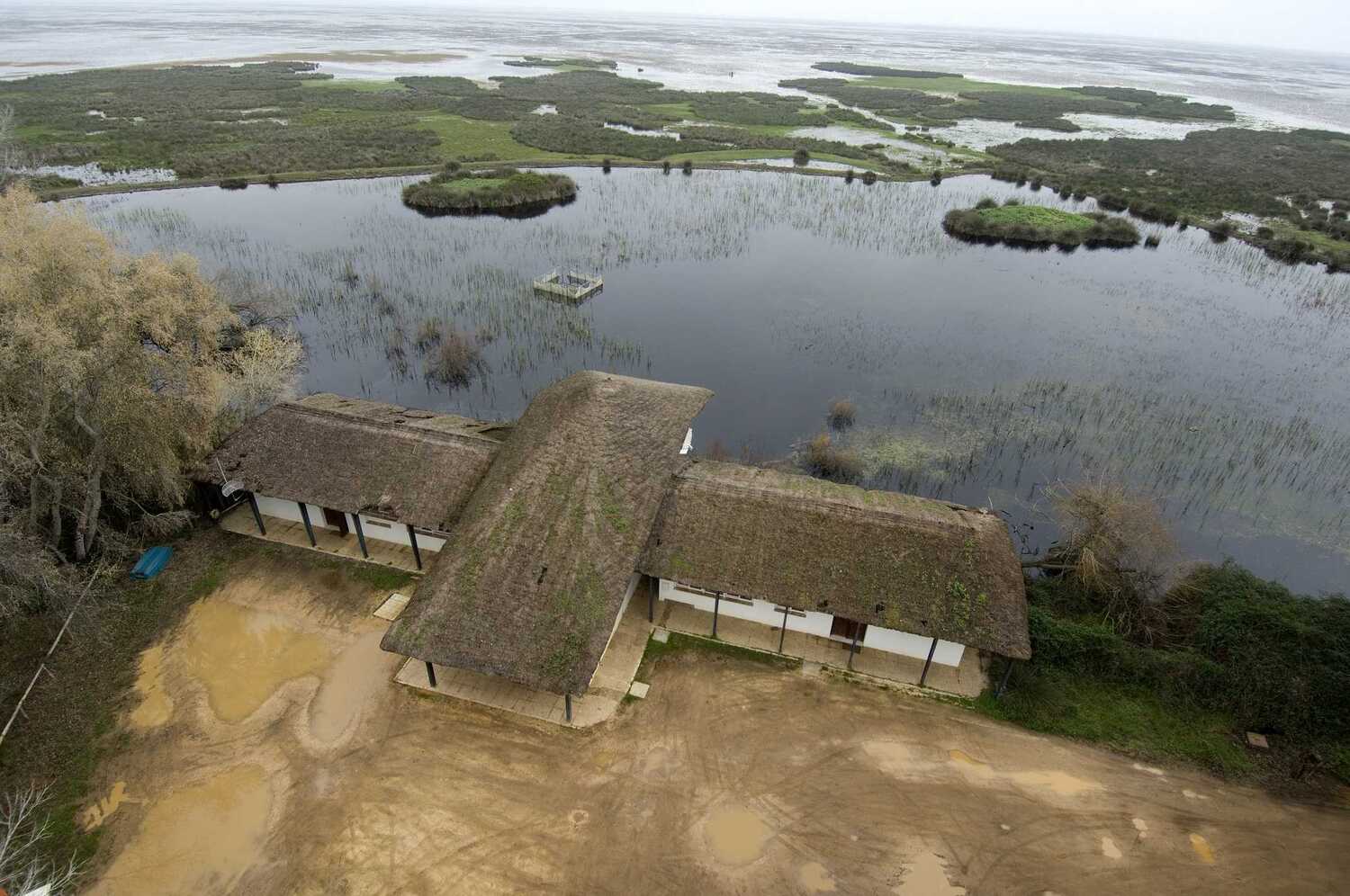
Doñana Biological Reserve (RBD)
The RBD is located in the Doñana National Park (Huelva) in the southeast of the Iberian peninsula.
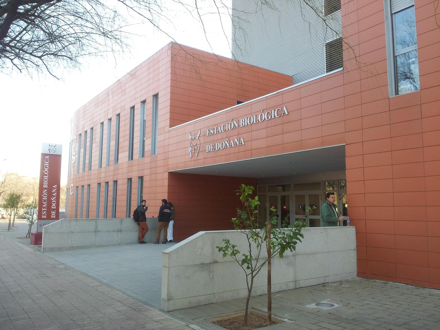
It was created in 1964 by the CSIC, and is managed by the Doñana Biological Station, a research branch of the CSIC based in Seville.
Due to its exclusive location, it is considered an ideal facility for field research and the exchange of experiences related to the environmental impact of global change.
Some data and figures
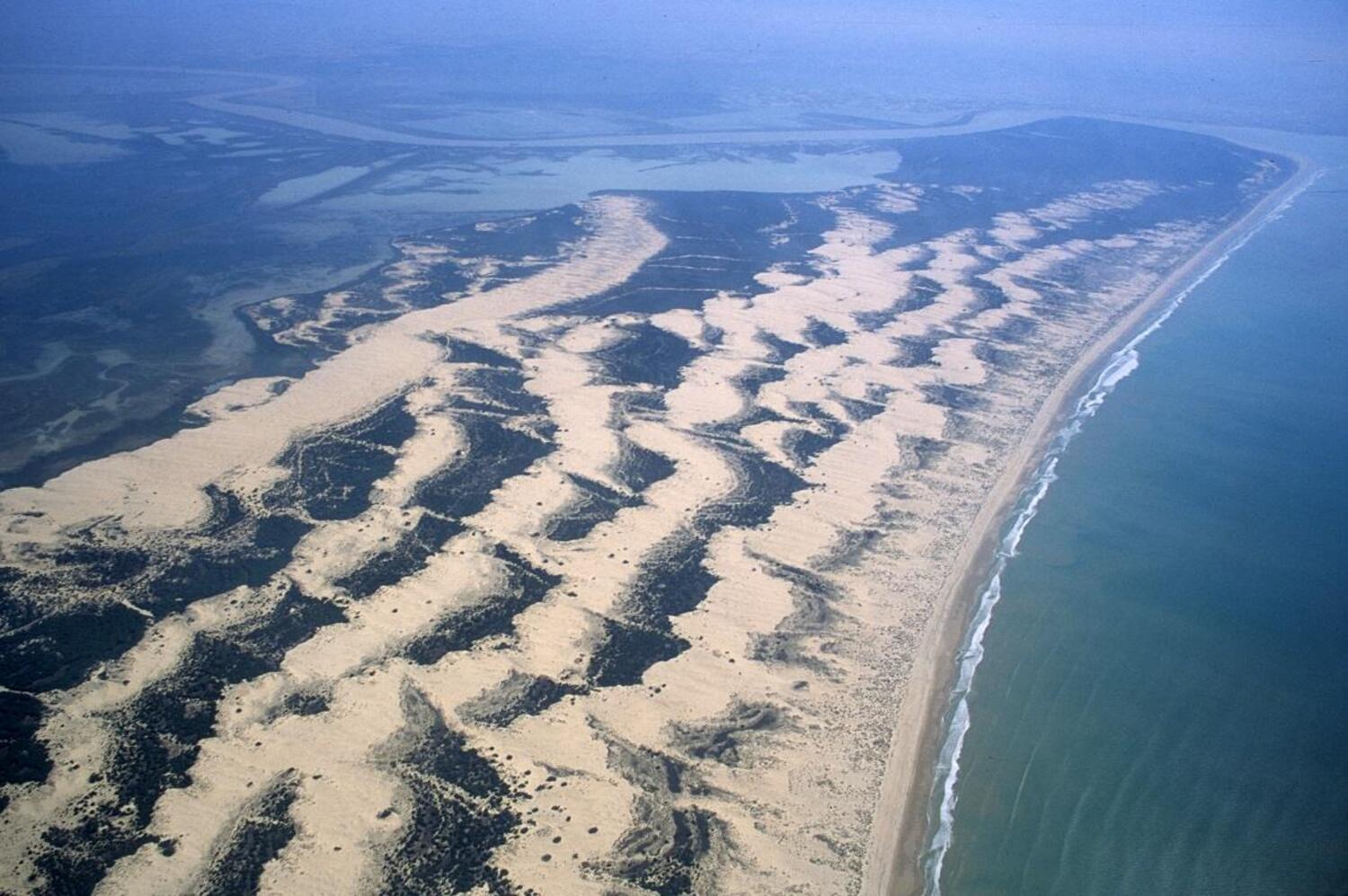
The RBD covers 6794 ha, and there are an additional 3214 ha belonging to the Guadiamar Biological Reserve.
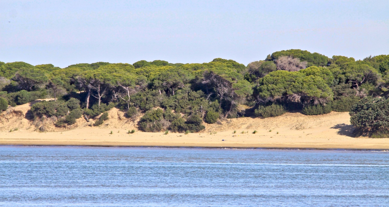
There are 4 ecosystems in the RBD: the beach, the dunes, the Mediterranean scrubland and the marshes.
More than 700,000 water birds descend on the marshes every year.
The RBD databases contain physical and biological data recorded systematically over the last 30 years.
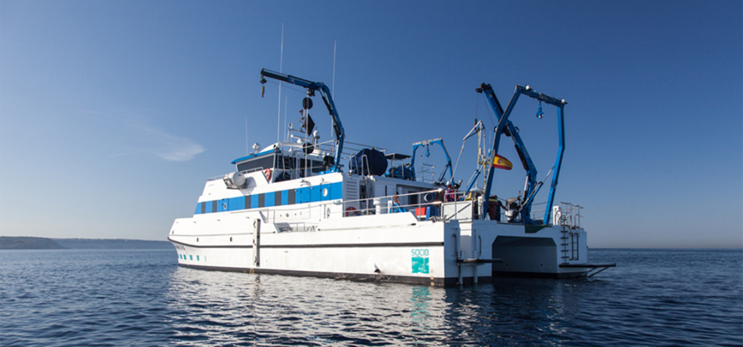
Balearic Islands Coastal Observing and Forecasting System (SOCIB)
SOCIB is managed by a consortium funded 50/50 by State Government and the Regional Government of the Autonomous Community of the Balearic Islands. Located in Palma de Mallorca, it has been operational since 2013.
SOCIB centres its activity around the western Mediterranean, including the Balearic Islands and surrounding areas (Alboran Sea, Algerian Basic, etc.). Due to its strategic position, close to where the Mediterranean and the Atlantic meet, it is one of the world’s ‘hot spots’ for biodiversity.
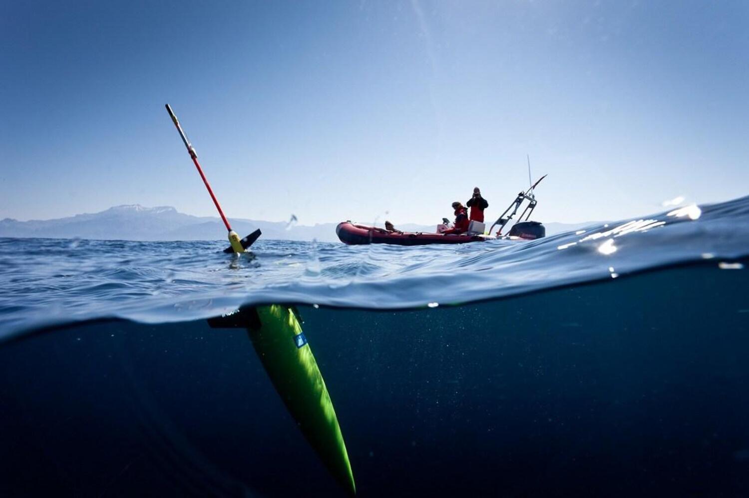
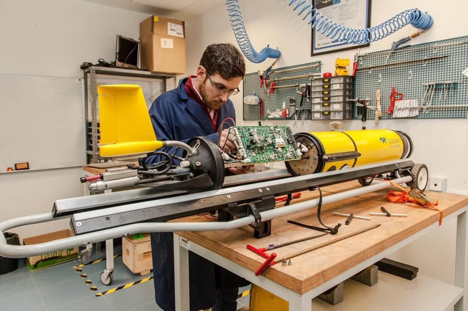
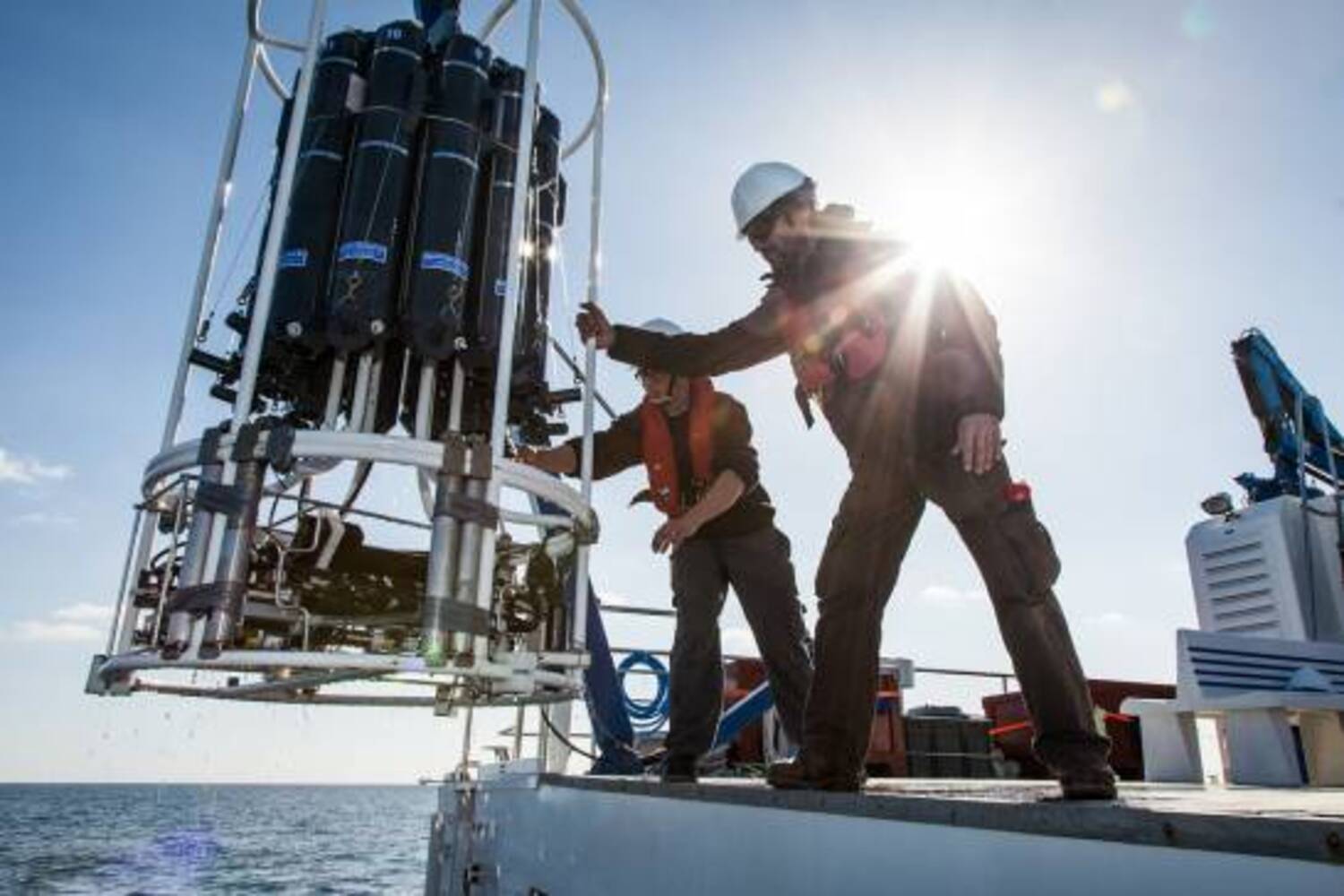
SOCIB consists of a network of facilities and teams dedicated to marine observation; operational data acquisition, processing, analysis and modelling; and the systematic dissemination of multidisciplinary information related to the marine environment.
The synergy between the different observation systems (oceanographic catamaran, high-frequency radars, autonomous underwater vehicles, buoys, ARGO profiling floats, etc.), prediction systems, data-assimilation tools, and the data-distribution and management system, provides a comprehensive overview of the physical and biogeochemical properties of the marine and coastal ecosystems and their evolution.